Skip to content
STELLA NOVARESEARCH PROJECTS
Chichén Itzá

Home Projects Chichén Itzá HeritageView Project Student Participation & Fieldwork

Student Participation & Fieldwork

Chichén Itzá HeritageView Project

The Chichén Itzá HeritageView Project is a living laboratory where students, faculty, and community partners collaborate to document, model, and interpret the site using advanced digital tools and on-the-ground research.

Students contribute across the full lifecycle of the initiative—from field data collection and 3D modeling to systems development, rental operations, business frameworks, and publication.

▱ Build accurate site models♙ Design immersive experiences◇ Validate technologies and operations↗ Develop sustainable business models
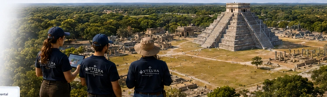
Stella Nova students conducting fieldwork at Chichén Itzá

1 Roles & pathways

GIS Analyst

Responsibilities

Mapping and spatial data

Learning outcomes

Applied methods, professional workflows, and portfolio-ready deliverables.

Field component
Survey & Ground Control

3D Modeler

Responsibilities

Asset and environment creation

Learning outcomes

Applied methods, professional workflows, and portfolio-ready deliverables.

Field component
Capture & Validation

Historical Researcher

Responsibilities

Sources and interpretation

Learning outcomes

Applied methods, professional workflows, and portfolio-ready deliverables.

Field component
Archival & On-Site Correlation

Animator

Responsibilities

Character and motion

Learning outcomes

Applied methods, professional workflows, and portfolio-ready deliverables.

Field component
Performance Validation

Business Analyst

Responsibilities

Operations and finance

Learning outcomes

Applied methods, professional workflows, and portfolio-ready deliverables.

Field component
Stakeholder Engagement

Field-Testing Assistant

Responsibilities

On-site validation and UX

Learning outcomes

Applied methods, professional workflows, and portfolio-ready deliverables.

Field component
On-Site Testing & Observation

2 Fieldwork calendar View full calendar

  • Site Survey & GCP Collection Photogrammetry capture
  • Photogrammetry Capture Site models
  • Field Validation & User Testing Experience checks
  • Kiosk Operations Pilot Rental workflows
  • Final Validation & Wrap-Up Reporting

3 Safety & approvals checklist

  • IRB / ethics review, if applicable
  • Field safety training
  • Site access permit Approved
  • Insurance & medical coverage Valid
  • Equipment check & calibration Complete
  • Emergency plan review Complete
Download fieldwork guide ↗

4 Travel & equipment

Travel & lodging

  • Merida Airport logistics
  • Ground transport provided
  • Student housing near site

Equipment checklist

  • GNSS unit / total station
  • 360° camera / DSLR
  • Drones / LiDAR / RGB
  • Laptops & storage
  • HeritageView glasses
  • Safety gear & field kit
View packing & logistics guide ↗

5 Current openings / placements

  • GIS Analyst (2) Open
  • 3D Modeler (3) Open
  • Historical Researcher (1) Open
  • Animator (2) Open
  • Business Analyst (1) Open
  • Field-Testing Assistant (4) Open
Apply or inquire →

6 Field data to model & systems pipeline

Field captureData processingModelingSystems integrationValidation & feedback
Field feedback continuously improves models and systems.

7 Kiosk operations / rental validation

Rental workflow
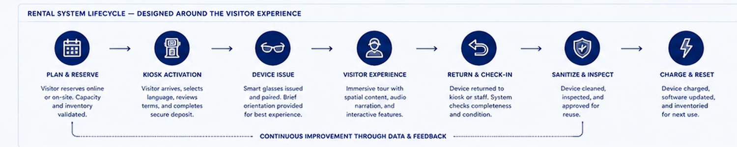
  • Test rental workflows and customer journey
  • Validate personas, content, and duration
  • Track usage, uptime, and maintenance
  • Gather visitor feedback on experience
2
Pilot sites
4
Kiosks deployed
1,248
Sessions logged
4.6/5
Avg. satisfaction

8 Systems integration (HeritageView™)

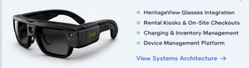
HeritageView V1
  • Wearable display for immersive interpretation
  • Location-locked content and guided experiences
  • Integrated with site models and live data
  • Designed for balanced passive wear
Technology partner: HeritageView →

10 Mentoring & supervision structure

Project DirectorOverall oversightFaculty LeadsDomain mentorsStudent TeamsRole leadsCommunity PartnersLocal advisors

11 Methodological note

Our integrated methodology combines archaeological rigor, advanced geospatial capture, and human-centered design to produce accurate, usable, and responsible digital heritage applications.

Read full methodological note →

12 Research community comments

“The student team’s integration of field data into a live model pipeline is exemplary.”Dr. Elena Martínez, Heritage Technology Researcher
Read all community comments →

Technology credit

HeritageView

HeritageView technology is integrated to support immersive field validation and interpretation.

About HeritageView →